Research Professor Alumni
Jinah Eom
> Yonsei University (Remote Sensing) Earth System Sciences (Ph.D). 2016
> Korea Institute of Ocean SCience and Technology (KIOST). 2017
> Natural Science Research Institute of Yonsei University. 2009
> Groundwater and Soil Environments Research Institute of
Yonsei University. 2009
> Natural Science Research Institute of Yonsei University. 2008
> Research topic
- Ocean color remote sensing (suspended sediment monitoring)
- Coastal remote sensing (Tidal flat monitoring)
> E-mail: jina9003@kangwon.ac.kr
1) Wahyu, Luqmanul Hakim.; Arief, Rizqiyanto Achmad.; Jinah, Eom.; and Chang-Wook, Lee.(2020): Land Subsidence Measurement of Jakarta Coastal Area Using Time Series Interferometry with Sentinel-1 SAR Data, Journal of Coastal Research, Vol.102, No.Sp1, pp. 75-81 .
2) Arief R, Achmad,; Seulki, Lee.; Sungjae, Park.; Jinah, Eom.; and Chang-Wook, Lee.(2020): Estimating the potential risk of the Mt. .Baekdu Volcano using a synthetic interferogram and the LAHARZ inundation zone, Geosciences Journal, Vol.24, No.6, pp. 755-768 .
3) Eom, Jinah., Park, Sungjae., Ko, Bokyun., Lee, Chang-Wook.*(2020): Monitoring of Lake area Change and Drought using Landsat Images and the Artificial Neural Network Method in Lake Soyang, Chuncheon, Korea, The Journal of the Korean Earth Science Society, Vol. 41, No. 2, pp. 129-136.
Ph.D Degree Alumni

Suci Ramayanti
> Bandung Institute of Technology, Department of Physics (Master). 2020
> Indonesia University of Education, Assistant Professor. Aug. 2024.~
> Research topic
- Utilization of InSAR and GIS in natural hazard assessments
> E-mail : suciramayanti@kangwon.ac.kr
1) Ramayanti, S., Kim, B., Park, S., & Lee, C. W. (2024). Wildfire susceptibility mapping by incorporating damage proxy maps, differenced normalized burn Ratio, and deep learning algorithms based on sentinel-1/2 data: a case study on Maui Island, Hawaii. GIScience & Remote Sensing, 61(1), 2353982.
2) Ramayanti, S., Park, S., Lee, C. W., & Park, Y. C. (2023). High-resolution imaging coupled with deep learning model for classifying water body of Soyang Lake, South Korea. Geosciences Journal, 27(6), 801-813.
3) Ramayanti, S., Nur, A. S., Syifa, M., Panahi, M., Achmad, A. R., Park, S., & Lee, C. W. (2022). Performance comparison of two deep learning models for flood susceptibility map in Beira area, Mozambique. The Egyptian Journal of Remote Sensing and Space Science, 25(4), 1025-1036.
4) Ramayanti, S., Achmad, A. R., Jung, H. C., Jo, M. J., Kim, S. W., Park, Y. C., & Lee, C. W.* (2022). Measurement of surface deformation related to the December 2018 Mt. Etna eruption using time-series interferometry and magma modeling for hazard zone mapping. Geosciences Journal, 1-17.
5) Hakim, W.L., Ramayanti, S., Park, S., Ko, B., Cheong, D.-K., Lee, C.-W*.(2022) Estimating the Pre-Historical Volcanic Eruption in the Hantangang River Volcanic Field: Experimental and Simulation Study. Remote Sensing, 14, 894.
6) Park, S., Lee, S., Ramayanti, S., Park, E., & Lee, C.-W. (2023). Observation and Analysis of Green Algae Phenomenon in Soyang-ho in 2023 Using Satellite Images. Korean Journal of Remote Sensing
7) Ramayanti, S., Kim, B. C., Park, S., & Lee, C.-W. (2022). Performance of Support Vector Machine for Classifying Land Cover in Optical Satellite Images: A Case Study in Delaware River Port Area. Korean Journal of Remote Sensing, 38(6_4), 1911–1923.
Mahdi Panahi
> University of Hawai’i at Mānoa Civil and Environmental Engineering (Postdoctoral researcher). 2022~
> Kangwon National University Division of Science Education (Ph.D). 2022
> Islamic Azad University Geophysics (Master). 2010
> Research topic
- Hazard assessment using machine learning algorithms
> E-mail : mahdipan@gmail.com
1) Ramayanti, S., Nur, A. S., Syifa, M., Panahi, M., Achmad, A. R., Park, S., & Lee, C. W. (2022). Performance comparison of two deep learning models for flood susceptibility map in Beira area, Mozambique. The Egyptian Journal of Remote Sensing and Space Science, 25(4), 1025-1036.
2) Fadhillah, M. F., Hakim, W. L., Panahi, M., Rezaie, F., Lee, C. W., & Lee, S. (2022). Mapping of landslide potential in Pyeongchang-gun, South Korea, using machine learning meta-based optimization algorithms. The Egyptian Journal of Remote Sensing and Space Science, 25(2), 463-472.
3) Panahi, M., Rahmati, O., Kalantari, Z., Darabi, H., Rezaie, F., Moghaddam, D. D., ... & Lee, S. (2022). Large-scale dynamic flood monitoring in an arid-zone floodplain using SAR data and hybrid machine-learning models. Journal of Hydrology, 128001.
4) Panahi, M., Khosravi, K., Golkarian, A., Roostaei, M., Barzegar, R., Omidvar, E., ... & Lee, S. (2022). A country-wide assessment of Iran's land subsidence susceptibility using satellite-based InSAR and machine learning. Geocarto International, (just-accepted), 1-18.
5) Hakim, W. L., Nur, A. S., Rezaie, F., , Panahi, M., Lee, C. W., & Lee, S. (2022). Convolutional neural network and long short-term memory algorithms for groundwater potential mapping in Anseong, South Korea. Journal of Hydrology: Regional Studies, 39, 100990.
6) Hakim, W. L., Rezaie, F., Nur, A. S., Panahi, M., Khosravi, K., Lee, C. W., & Lee, S. (2022). Convolutional neural network (CNN) with metaheuristic optimization algorithms for landslide susceptibility mapping in Icheon, South Korea. Journal of environmental management, 305, 114367.
7) Panahi, M., Khosravi, K., Ahmad, S., Panahi, S., Heddam, S., Melesse, A. M., ... & Lee, C. W. (2021). Cumulative infiltration and infiltration rate prediction using optimized deep learning algorithms: A study in Western Iran. Journal of Hydrology: Regional Studies, 35, 100825.
8) Alireza, Vafaeinejad.; Samira, Bolouri .; Ali, Asghar Alesheikh.; Mahdi, Panahi.; and Chang-Wook, Lee.(2020): The Capacitated Location-Allocation Problem Using the VAOMP (Vector Assignment Ordered Median Problem) Unified Approach in GIS (Geospatial Information Systam), applied sciences, Vol.10, No.23, pp. 1-22 .
9) Esmaeel, Dodangeh.; Mahdi, Panahi.; Fatemeh, Rezaie.; Saro, Lee.; Dieu, Tien Bui.; Chang-Wook, Lee.; and Biswajeet, Pradhan.(2020): Novel hybrid intelligence models for flood-susceptibility prediction: Meta optimization of the GMDH and SVR models with the genetic algorithm and harmony search, Journal of Hydrology, Vol. 590, pp. 1-14 .
10) Syifa, M.; Panahi, M.; and Lee, C.-W. (2020): Mapping of Post-Wildfire Burned Area Using a Hybrid Algorithm and Satellite Data: The Case of the Camp Fire Wildfire in California, USA , Remote Sensing, Vol. 12, Issue. 4, pp. 1-20.
Master Degree Alumni
Prima Riza Kadavi
> Kangwon National University Division of Science Education (Master). 2019
- Application of Machine Learning Technique for Groundwater Potential Mapping
> Jenderal Soedirman University Geological Engineering, (Bachelor). 2016
>Research topic
- Remote sensing data for land cover classification in volcano area
- GIS modelling for landslide susceptibility
> E-mail : rizakadavi@gmail.com
1) Syifa, M., Kadavi, P.R., Lee, C.-W.; Alamri, A.M. (2020): Landsat images and artificial intelligence techniques used to map volcanic ashfall and pyroclastic material following the eruption of Mount Agung, Indonesia , Arabian Journal of Geosciences, Vol. 13, Issue. 3, pp. 133.
2) Kadavi, P.-R, Lee, C.-W, S.-R. Lee (2019): Landslide-susceptibility mapping in Gangwon-do, South Korea, using logistic regression and decision tree models, Environmental Earth Sciences, Vol. 78, NO. 116.
3) Syifa, M, Kadavi, P.-R, Lee, C.-W (2019): An Artificial Intelligence Application for Post-Earthquake Damage Mapping in Palu, Central Sulawesi, Indonesia, Sensors, Vol. 19, NO. 3, 542.
4) Kadirhodjaev, A.-Z., Kadavi, P.-R, Lee, C.-W & S.-R. Lee (2018): Analysis of the relationships between topographic factors and landslide occurrence and their application to landslide susceptibility mapping: a case study of Mingchukur, Uzbekistan, Geosciences Journal, Vol. 22, NO. 6, 1053–1067.
5) Oh, H.-J., Kadavi, P.-R, Lee, C.-W & S.-R. Lee (2018): Evaluation of landslide susceptibility mapping by evidential belief function, logistic regression and support vector machine models, Geomatics, Natural Hazards and Risk, Vol. 9, NO. 1, 1053–1070.
6) Park, S.-J., Kadavi, P.-R, C.-W. Lee*(2018): Landslide Susceptibility Apping and Comparison Using Probabilistic Models: A Case Study of Sacheon, Jumunzin Area, Korea , Korea Journal of Remote Sensing, Vol. 34, No. 5, 721-738.
7) Prima Riza, K. and Lee, C.-W and S.-R. Lee (2018): Application of Ensemble-Based Machine Learning Models to Landslide Susceptibility Mapping, Remote Sensing, 10(8), 1252.
8) Prima Riza, K. and Lee, C.-W( 2018): Land cover classification analysis of volcanic island in Aleutian Arc using an Artificial Neural Network (ANN) and a Support Vector Machine (SVM) from Landsat imagery, Geosciences Journal, Vol. 22, Issue 4, pp 653–665.
9) Prima Riza, K., W.-J, Lee and Lee, C.-W (2017): Analysis of the Pyroclastic Flow Deposits of Mount Sinabung and Merapi Using Landsat Imagery and the Artificial Neural Networks Approach. Applied Sciences, Vol.7, No.9, 935-949.
Mutiara Syifa
> Kangwon National University Division of Science Education (Master). 2020
- Earth Science and Remote Sensing Analysis from Educational and Scientific Perspectives in Addressing Natural Disasters
> Indonesia University of Education Division of Physics Education (Bachelor). 2017
>Research topic
- Monitoring of topographic change of sandbar
> Email : mutiarsyifa@gmail.com
1) Syifa, M.; Panahi, M.; Lee, C.-W. (2020): Mapping of Post-Wildfire Burned Area Using a Hybrid Algorithm and Satellite Data: The Case of the Camp Fire Wildfire in California, USA , Remote Sensing, Vol. 12, Issue. 4, pp. 623.
2) Syifa, M., Kadavi, P.R., Lee, C.-W.; Alamri, A.M. (2020): Landsat images and artificial intelligence techniques used to map volcanic ashfall and pyroclastic material following the eruption of Mount Agung, Indonesia , Arabian Journal of Geosciences, Vol. 13, Issue. 3, pp. 133.
3) Oh, H.-J.; Syifa, M.; Lee, C.-W., and Lee, S. (2019): Ruditapes philippinarum Habitat Mapping Potential Using SVM and Naïve Bayes , Journal of Coastal Research, Special Issue No. 90, pp. 41-48.
4) Eom, J.; Park, W.; Syifa, M.; Lee, C., and Yoon, S. (2019): Monitoring Variation in Sea Surface Temperature in the Nakdong River Estuary, Korea, Using Multiple Satellite Images ,Journal of Coastal Research, Special Issue No. 90, pp. 183-189
5) Syifa, M.; Park, S.-J.; Achmad, A.-R.; Lee, C.-W., and Eom, J. (2019): Flood Mapping Using Remote Sensing Imagery and Artificial Intelligence Techniques: A Case Study in Brumadinho, Brazil , Journal of Coastal Research, Special Issue No. 90, pp. 197-204.
6) Achmad, A.R.; Syifa, M.; Park, S.J.; and Lee, C.W. (2019): Geomorphological Transition Research for Affecting the Coastal Environment due to the Volcanic Eruption of Anak Krakatau by Satellite Imagery , Journal of Coastal Research, Special Issue No. 90, pp. 214-220.
7) Park, S.-J.; Achmad, A.R.; Syifa, M., and Lee, C.-W. (2019): Machine Learning Application for Coastal Area Change Detection in Gangwon Province, South Korea Using High-Resolution Satellite Imagery , Journal of Coastal Research, Special Issue No. 90, pp. 228-235.
8) Lee, S.; Syifa, M.; Koo, B.J.; Lee, C.-W., and Oh, H.-J. (2019): Spatial Macrobenthos Habitat on Ganghwa Tidal Flat, Korea: Part II - Habitat Potential Mapping of Potamocorbula laevis Using Probability Models , Journal of Coastal Research, Special Issue No. 90, pp. 401-408.
9) Oh, H.-J.,Syifa, M, Lee, C.-W & S.-R. Lee (2019): land subsidence susceptibility mapping using Bayesian, Functional, and Meta-Ensemble Machine Learning Models, Applied Sciences, Vol. 9, NO. 6, 1248.
10) Syifa, M, Kadavi, P.-R, Lee, C.-W (2019): An Artificial Intelligence Application for Post-Earthquake Damage Mapping in Palu, Central Sulawesi, Indonesia, Sensors, Vol. 19, NO. 3, 542.
10) Syifa, M, Kadavi, P.-R, Lee, C.-W (2019): An Artificial Intelligence Application for Post-Earthquake Damage Mapping in Palu, Central Sulawesi, Indonesia, Sensors, Vol. 19, NO. 3, 542.
Arief Rizqiyanto Achmad
> Kangwon National University Division of Science Education (Master). 2020
> Indonesia University of Education Division of Physics (Bachelor). 2018
> Research Topic
- Hazard Assessment for post-eruption of volcano and post-flood mapping
> Email : ariefrizqiyanto@kangwon.ac.kr
1) Wahyu, Luqmanul Hakim.; Arief, Rizqiyanto Achmad.; Jinah, Eom.; and Chang-Wook, Lee.(2020): Land Subsidence Measurement of Jakarta Coastal Area Using Time Series Interferometry with Sentinel-1 SAR Data, Journal of Coastal Research, Vol.102, No.Sp1, pp. 75-81 .
2) Arip, Syaripudin Nur.; Arief, Rizqiyanto Achmad.; and Chang-Wook, Lee.(2020): Land Subsidence Measurement in Reclaimed Coastal Land: Noksan Using C-Band Sentinel-1 Radar Interferometry, Journal of Coastal Research, Vol.102, No.sp1, pp. 218-223 .
3) Wahyu, Luqmanul Hakim.; Arief, Rizqiyanto Achmad.; and Chang-Wook, Lee.(2020): Land Subsidence Susceptibility Mapping in Jakarta Using Functional and Meta-Ensemble Machine Learning Algorithm Based on Time-Series InSAR Data, remote sensing, Vol.12, No.21, pp. 1-25 .
4) Muhammad, Fulki Fadhillah.; Arief, Rizqiyanto Achmad.; and Chang-Wook, Lee.(2020): Integration of InSAR Time-Series Data and GIS to Assess Land Subsidence along Subway Lines in the Seoul Metropolitan Area, South Korea, remote sensing, Vol.12, No.21, pp. 1-25 .
5) Arief R, Achmad,; Seulki, Lee.; Sungjae, Park.; Jinah, Eom.; and Chang-Wook, Lee.(2020): Estimating the potential risk of the Mt. .Baekdu Volcano using a synthetic interferogram and the LAHARZ inundation zone, Geosciences Journal, Vol.24, No.6, pp. 755-768 .
Arip Syaripudin Nur
> Lamar University College of Engineering (Ph.D). 2022~
> Kangwon National University Division of Science Education (Master). 2022
> Indonesian University of Education, Division of Physics (Bachelor). 2017
> Research Topic
- SAR Interferometry
> Email : aripsyaripudin@kangwon.ac.kr
1) Ramayanti, S., Nur, A. S., Syifa, M., Panahi, M., Achmad, A. R., Park, S., & Lee, C. W. (2022). Performance comparison of two deep learning models for flood susceptibility map in Beira area, Mozambique. The Egyptian Journal of Remote Sensing and Space Science, 25(4), 1025-1036.
2) Nur, A. S., Kim, Y. J., & Lee, C. W. (2022). Creation of wildfire susceptibility maps in plumas national forest using InSAR coherence, deep learning, and metaheuristic optimization approaches. Remote Sensing, 14(17), 4416.
3) Arip Syaripudin Nur, Muhammad Fulki Fadhillah, Young-Hoon Jung, Boo Hyun Nam, Yong Je Kim, Yu-Chul Park, Chang-Wook Lee. (2022). Damage Proxy Map over Collapsed Structure in Ansan Using COSMO-SkyMed Data. The Journal of Engineering Geology, 32(3), 363-376
4) Hakim, W. L., Nur, A. S., Rezaie, F., , Panahi, M., Lee, C. W., & Lee, S. (2022). Convolutional neural network and long short-term memory algorithms for groundwater potential mapping in Anseong, South Korea. Journal of Hydrology: Regional Studies, 39, 100990.
5) Hakim, W. L., Rezaie, F., Nur, A. S., Panahi, M., Khosravi, K., Lee, C. W., & Lee, S. (2022). Convolutional neural network (CNN) with metaheuristic optimization algorithms for landslide susceptibility mapping in Icheon, South Korea. Journal of environmental management, 305, 114367.
6) Han, J., Nur, A. S., Syifa, M., Ha, M., Lee, C. W., & Lee, K. Y. (2021). Improvement of Earthquake Risk Awareness and Seismic Literacy of Korean Citizens through Earthquake Vulnerability Map from the 2017 Pohang Earthquake, South Korea. Remote Sensing, 13(7), 1365.
7) Nur, A. S., & Lee, C. W. (2021). Damage Proxy Map (DPM) of the 2016 Gyeongju and 2017 Pohang Earthquakes Using Sentinel-1 Imagery. Korean Journal of Remote Sensing, 37(1), 13-22.
8) Arip, Syaripudin Nur.; Arief, Rizqiyanto Achmad.; and Chang-Wook, Lee.(2020): Land Subsidence Measurement in Reclaimed Coastal Land: Noksan Using C-Band Sentinel-1 Radar Interferometry, Journal of Coastal Research, Vol.102, No.sp1, pp. 218-223 .
9) Nur, A. S., Park, S., Lee, K. J., Moon, J., & Lee, C. W. (2020). Mapping of Post-Wildfire Burned Area Using KOMPSAT-3A and Sentinel-2 Imagery: The Case of Sokcho Wildfire, Korea. Korean Journal of Remote Sensing, 36(6-2), 1551-1565.
Raisa Najma Sakina
> Indonesia University of Education, Division of Physics (Bachelor). 2022
> Research Topic
- SAR Interferometry and GIS in natural hazard assessments
> Email : raisaarifinn@kangwon.ac.kr
Undergraduates Alumni
Hyeonwoo Ji
> Kangwon National University Division of Science Education
> Email : wower854@kangwon.ac.kr
Eunchae Lee
> Kangwon National University Division of Science Education
> Email : edp125@kangwon.ac.kr
Minsu Song
> Kangwon National University Division of Science Education
> Email : song900634@naver.com

Hongjun Byun
> Kangwon National University Division of Science Education
> Email : goodhongjun@gmail.com
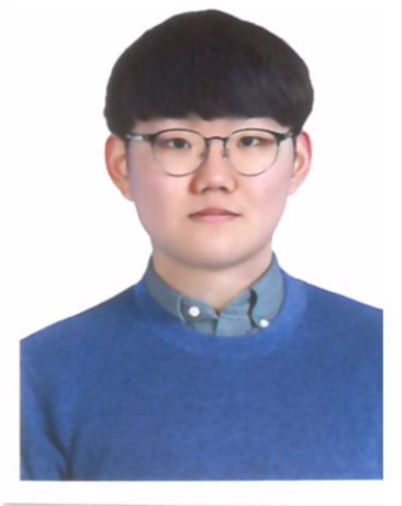
Jongseong Song
> Kangwon National University Division of Science Education
> Email : whdtjd8626@naver.com
Research Assistant Alumni
Subin Ryoo
> Kangwon National University Earth Observation Laboratory (Assistance Research). 2017 ~ 2020
> Email : plumerry@kangwon.ac.kr
- Head of laboratory accounting
- Research fund computation system the person in charge
- Website construction and management (https://www.keol.kr/)
- Online journal editorial secretary (http://www.geodata.kr/)
- Logo, panel, and pamphlet production (Photoshop & Illustration)
- 3D modeling of 3D terrain information
- GIS research assistance in geological field
- Holding various seminars and workshops
- Proposal design
1) Syifa, M., Ryoo, S.-B., Lee, C.-W. (2019): Post-Earthquake Damage Mapping Using Artificial Neural Network and Support Vector Machine Classifiers at Palu, Indonesia. IGARSS 2019-2019 IEEE International Geoscience and Remote Sensing Symposium.
2) Lee, C.-W., Lee, S.-K, Park, S.-J., Ryoo, S.-B. (2018): Apparatus and method for analyzing dangerous of floodi2) Lee, C.-W., Lee, S.-K, Park, S.-J., Ryoo, S.-B. (2018): Apparatus and method for analyzing dangerous of flooding or drought using machine-learning. 10-2018-0131526ng or drought using machine-learning. 10-2018-0131526

HanBit Hwang
> KEOL Administrative work & Research assistant. 2021 ~ 2024
> E-mail : hwanghanbit@kangwon.ac.kr

Kangwon National University Earth Observation Laboratory
KNU Chuncheon Campus 1, Gangwondaehakgil, Chuncheon-si, 24341 Republic of Korea
Kangwon National University College of Education #4 - 301. TEL : +82.33.250.7923
